Geo-Eye
Department of Geography & GIS
Department of Geography & GIS
Geo-Eye
Year: 2023, Volume: 12, Issue: 2, Pages: 44-48
Original Article
R Shiva Kumar1,*
1 Guest Faculty, Dept. of Geography, Bangalore University, Jnanabharathi Campus, Bengaluru
*Corresponding author email: [email protected]
Received Date:12 August 2023, Accepted Date:18 November 2023
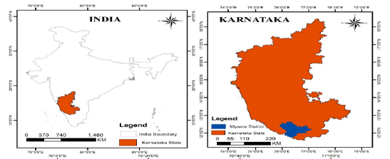
The purpose of this study is to examine the dynamics of land use and land cover in Mysuru District from 2018 to 2022 utilizing geographic information system (GIS) tools and remote sensing techniques. We used Sentinel-2 land cover data from the Environmental Systems Research Institute, Inc. (ESRI) to examine changes in shrubland, built-up areas, agricultural land, water bodies, and vegetation. Land cover patterns were analyzed and their temporal and spatial trends determined using image classification, change detection analysis, and theme mapping. The study emphasizes how crucial it is to comprehend land use dynamics in order to make wise decisions and implement sustainable land management techniques in the area.
Keywords
Mysuru District, Land Use, Land Cover, Sentinel2, Remote Sensing, GIS, Sustainability, Environmental Monitoring
Lambin, E. F., Rounsevell, M. D. A., & Geist, H. J. (2000). Are agricultural land-use models able to predict changes in land use intensity? Agriculture, Ecosystems & Environment, 82, 321–331.
Turner, B. L., Meyer, W. B., & Skole, D. L. (1994). Global land-use/land-cover change: Towards an integrated study. Ambio, 23(1), 91-95.
Environmental Systems Research Institute, Inc. (ESRI)
Roy, P. S., & Roy, A. (2010). Land use and land cover change: A remote sensing & GIS perspective. Journal of the Indian Institute of Science, 90(4), 489-502.
Seyam, M. M. H., Haque, M. R., & Rahman, M. M. (2023). Identifying the land use land cover (LULC) changes using remote sensing and GIS approach: A case study at Bhaluka in Mymensingh, Bangladesh. Case Studies in Chemical and Environmental Engineering, 7, 100293. Elsevier.
Gaur, S., & Singh, R. (2023). A Comprehensive Review on Land Use/Land Cover (LULC) Change Modeling for Urban Development: Current Status and Future Prospects. Sustainability, 15(2), 903. https://doi.org/10.3390/su15020903
Vivekananda, G. N., Swathi, R., & Sujith, A. V. L. N. (2021). Multi-temporal image analysis for LULC classification and change detection. European Journal of Remote Sensing, 54(sup2), 189-199. https://doi.org/10.1080/22797254.2020.1771215
© 2023 Kumar. This is an open-access article distributed under the terms of the Creative Commons Attribution License, which permits unrestricted use, distribution, and reproduction in any medium, provided the original author and source are credited.
Subscribe now for latest articles and news.