Geo-Eye
Department of Geography & GIS
Department of Geography & GIS
Geo-Eye
DOI: 10.53989/bu.ge.v15.i1.26.12
Year: 2026, Volume: 15, Issue: 1, Pages: 32-44
Original Article
P C Nagesh1, G Satishkumar1*, K N Vinodh Kumar1, H Raveesh1, Siddalingayya R Nandimath1, D Nagaraju2
1Department of Geology, Bangalore University, Bangalore, Karnataka, India.
2DOS in Earth Science, Manasagangotri, University of Mysore, Mysuru, Karnataka, India
*Corresponding Author
Email: [email protected]
Received Date:15 July 2026, Accepted Date:07 August 2026
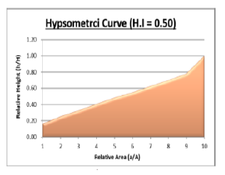
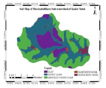
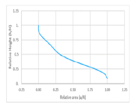
An assessment of the Lokapavani River Basin was carried out to analyze various drainage morphometric parameters using Remote Sensing (RS) and Geographic Information System (GIS) techniques. Drainage basin or watershed analysis based on morphometric parameters is crucial for effective watershed management and planning. The delineation of the drainage network was achieved using Digital Elevation Model (DEM) data, specifically Cartosat DEM, processed through ArcGIS software to extract key hydrological parameters of the basin. The Lokapavani River Basin covers an area of approximately 483.69 km² with a perimeter of 122.55 km. The computed morphometric parameters were categorized into three broad aspects: Linear, Areal and Relief. Under the Linear aspects, the highest stream order identified is sixth order, and the mean bifurcation ratio of 4.18 indicates that the basin is in a mature stage of geomorphic evolution. In the Aerial aspects, the drainage density (1.94) suggests a coarse drainage texture, while the stream frequency (2.56) reflects a moderate drainage network. The circularity ratio, form factor, elongation ratio, and shape factor collectively indicate that the basin possesses an elongated shape. Furthermore, the constant of channel maintenance and length of overland flow suggest the basin has a moderate slope and moderate permeability. Within the Relief aspects, the basin relief and relief ratio denote moderate to high relief and moderate slope conditions, while the dissection index value reveals that the basin is moderately dissected. The hypsometric integral value (0.46) further supports that the Lokapavani River Basin is in a mature geomorphic stage. Geomorphologically, the study area comprises pediments, pediplains, valley fills, structural hills, and residual hills. The predominant soil types in the basin include sandy clay, clay, clay loam and sandy clay loam, which influence both infiltration characteristics and run-off behaviour across the basin.
Keywords: Morphometry, Bifurcation Ratio, Drainage Density, Digital Elevation Model (DEM), Hypsometric Integral, Pediments and Pediplains
1. Awasthi AK, Rawat U, Dubey A, Dwivedi PK, Mishra SK, Tripathi SK. Morphometric Study of Bank River, Sub-Basin Watersheds of Sonar River (A Sub-Basin Of Ken River Basin) Using RS & GIS. International Journal of Current Advanced Research. 2019; 8 (1). Available from: http://doi.org/10.24327/ijcar.2019.16901.3142
2. Ashwini B, Avinash G, Shambhavi, Vignesh V, Gowda G. Morphometric and Hypsometric Analysis of Lokapavani River Basin Using ArcGIS. International Journal of Creative Research Thoughts. 2021; 9 Available from: https://scholar.google.com/citations?view_op=view_citation&hl=en&user=C-V_MBsAAAAJ&citation_for_view=C-V_MBsAAAAJ:zYLM7Y9cAGgC
3. Bishop M, Shroder J, Bonk R, Olsenholler J. Geomorphic Change in High Mountains: A Western Himalayan Perspective. Global and Planetary Change. 2002; 32 (4). Available from: https://doi.org/10.1016/s0921-8181(02)00073-5
4. Odiji CA, Aderoju OM, Eta JB, Shehu I, Mai-Bukar A, Onuoha H. Morphometric Analysis and Prioritization of Upper Benue River Watershed, Northern Nigeria. Applied Water Science. 2021; 11 (2). Available from: https://doi.org/10.1007/s13201-021-01364-x
5. Maury C, Sharma VN. A geomorphological study of Auranga river basin, Jharkhand using geospatial techniques. National Geographical Journal of India. 2022; 68 (3). Available from: https://doi.org/10.48008/ngji.1807
6. Choudhari PP, Nigam GK, Singh SK, Thakur S. Morphometric based prioritization of watershed for groundwater potential of Mula river basin, Maharashtra, India. Geology, Ecology, and Landscapes. 2018; 2 (4). Available from: https://doi.org/10.1080/24749508.2018.1452482
7. Clarke JI. (1996). Morphometry from Maps, Essays in geomorphology. Elsevier Publications, New York. Pp 235-274.
8. Das A, Mondal M, Das B, Ghosh AR. Analysis of Drainage Morphometry and Watershed Prioritization in Bandu Watershed, West Bengal through Remote Sensing and GIS Technology. International Journal of Geomatics and Geosciences. 2012; 2 (4). Available from: https://www.researchgate.net/publication/299746408_Analysis_of_drainage_morphometry_and_watershed_prioritization_in_Bandu_Watershed_Purulia_West_Bengal_through_Remote_Sensing_and_GIS_technology_-_A_case_study
9. Faniran. (1968). The Index of Drainage Intensity - A Provisional New Drainage Factor. Australian Journal of Science. Vol 31, Pp.328-330.
10. Fryirs KA, Brierley GJ. (2013). Geomorphic Analysis of River Systems: An Approach to Reading the Landscape. West Sussex: Wiley Blackwell Publication. Pp 29-62.
11. Gravelius H. (1914). Flusskunde, Goschensche Verlagshandlung, Berlin. Pp 176.
12. Horton RE. Erosional Development of Stream and Their Drainage Basin. Hydrogeological Approach to Quantitative Morphology. Bulletin of Geological Society of America. 1945; 56 (3). Available from: https://doi.org/10.1130/0016-7606(1945)56[275:EDOSAT]2.0.CO;2
13. Horton RE. Drainage‐basin characteristics. Eos, Transactions American Geophysical Union. 1932; 13 (1). Available from: https://doi.org/10.1029/tr013i001p00350
14. Hurtrez JE, Sol C, Lucazeau F. Effect of drainage area on hypsometry from an analysis of small-scale drainage basins in the Siwalik Hills (Central Nepal). Earth Surface Processes and Landforms. 1999; 24 (9). Available from: https://doi.org/10.1002/(sici)1096-9837(199908)24:9<799::aid-esp12>3.0.co;2-4
15. Qadir J, Bhat MS, Alam A, Rashid I. Mapping groundwater potential zones using remote sensing and GIS approach in Jammu Himalaya, Jammu and Kashmir. GeoJournal. 2020; 85 (2). Available from: https://doi.org/10.1007/s10708-019-09981-5
16. Pareta K, Pareta U. Quantitative Geomorphological Analysis of a Watershed of Ravi River Basin, H.P. India. International Journal of Remote Sensing and GIS. 2012; 1 (1). Available from: https://www.researchgate.net/publication/225284427_Quantitative_Geomorphological_Analysis_of_a_Watershed_of_Ravi_River_Basin_HP_India
17. Shekar PR, Mathew A. Morphometric analysis for prioritizing sub-watersheds of Murredu River basin, Telangana State, India, using a geographical information system. Journal of Engineering and Applied Science. 2022; 69 (1). Available from: https://doi.org/10.1186/s44147-022-00094-4
18. Shekar PR, Mathew A. Morphometric analysis of watersheds: A comprehensive review of data sources, quality, and geospatial techniques. Watershed Ecology and the Environment. 2024; 6 Available from: https://doi.org/10.1016/j.wsee.2023.12.001
19. Panhalkar SS, Malli SP, Pawar CT. Morphometric Analysis and Watershed Development Prioritization of Hiranyakeshi Basin in Maharastra, India. International Journal of Environmental Sciences. 2012; 3 (1). Available from: https://www.researchgate.net/publication/282002724_Morphometric_Analysis_and_Watershed_Development_Prioritization_of_Hiranyakeshi_Basin_In_Maharashtra_India
20. Kumar P, Joshi V. Geospatial- Statistical Approach to Alienate Priority Area of Upper Watershed of River Subarnarekha Using Morphometric Assessment Framework. Malaysian Journal of Geosciences. 2019; 3 (1). Available from: https://doi.org/10.26480/mjg.01.2019.21.31
21. Pradhan B. Groundwater potential zonation for basaltic watersheds using satellite remote sensing data and GIS techniques. Central European Journal of Geosciences. 2009; 1 (1). Available from: https://doi.org/10.2478/v10085-009-0008-5
22. Rai PK, Singh P, Mishra VN, Singh A, Sajan B, Shahi AP. Geospatial Approach for Quantitative Drainage Morphometric Analysis of Varuna River Basin, India. Journal of Landscape Ecology. 2019; 12 (2). Available from: https://doi.org/10.2478/jlecol-2019-0007
23. Rao DP. Remote Sensing Application in Geomorphology. International Society for Tropical Ecology. 2002; 43 (1). Available from: https://www.researchgate.net/publication/260403280_Remote_sensing_application_in_geomorphology
24. Rashid M, Lone MA, Ahmed S. Integrating geospatial and ground geophysical information as guidelines for groundwater potential zones in hard rock terrains of south India. Environmental Monitoring and Assessment. 2012; 184 (8). Available from: https://doi.org/10.1007/s10661-011-2305-2
25. Samal DR, Gedam SS, Nagarajan R. GIS based drainage morphometry and its influence on hydrology inparts ofWestern Ghats region, Maharashtra, India. Geocarto International. 2015; 30 (7). Available from: https://doi.org/10.1080/10106049.2014.978903
26. Adhikari S. Morphometric Analysis of a Drainage Basin: A Study of Ghatganga River, Bajhang District, Nepal. The Geographic Base. 2020; 7 Available from: https://doi.org/10.3126/tgb.v7i0.34280
27. Schumm SA. Evolution of Drainage Systems and Slopes in Badlands at Perth Amboy, New Jersey. Geological Society of America Bulletin. 1956; 67 (5). Available from: https://doi.org/10.1130/0016-7606(1956)67[597:eodsas]2.0.co;2
28. Smith KG. Standards for grading texture of erosional topography. American Journal of Science. 1950; 248 (9). Available from: https://doi.org/10.2475/ajs.248.9.655
29. Strahler AN. (1964). Quantitative Geomorphology of Drainage Basins and Channel Networks. In V T Chow (Ed) New York: McGraw Hill. Handbook of Applied Hydrology. Pp 4
30. Strahler AN. Hypsometric (Area-Altitude) Analysis of Erosional Topography. Geological Society of America Bulletin. 1952; 63 (11). Available from: https://doi.org/10.1130/0016-7606(1952)63[1117:haaoet]2.0.co;2
31. Sukristiyanti S, Mariya R, Lestiana H. Watershed-based Morphometric Analysis: A Review. IOP Conference Series: Earth and Environmental Science. 2018; 118 Available from: https://doi.org/10.1088/1755-1315/118/1/012028
32. Miller VC. A Quantitative Geomorphic Study of Drainage Basin Characteristics in the Clinch Mountain Area Virginia and Tennessee. Journal of Geology. 1957; 65 (1). Available from: https://doi.org/10.1086/626413
33. Pakhmode V, Kulkarni H, Deolankar SB. Hydrological-drainage analysis in watershed-programme planning: a case from the Deccan basalt, India. Hydrogeology Journal. 2003; 11 (5). Available from: https://doi.org/10.1007/s10040-003-0279-z
34. Farhan Y, Elgaziri A, Elmaji I, Ali I. Hypsometric Analysis of Wadi Mujib-Wala Watershed (Southern Jordan) Using Remote Sensing and GIS Techniques. International Journal of Geosciences. 2016; 07 (02). Available from: https://doi.org/10.4236/ijg.2016.72013
© 2026 Satishkumar et al. This is an open-access article distributed under the terms of the Creative Commons Attribution License, which permits unrestricted use, distribution, and reproduction in any medium, provided the original author and source are credited.
Published By Bangalore University, Bengaluru, Karnataka
Subscribe now for latest articles and news.