Abstract
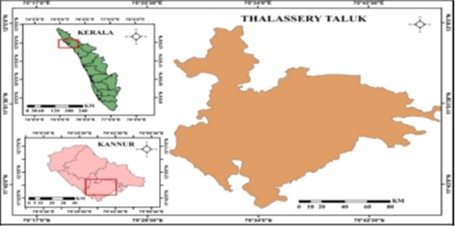
The depletion of groundwater resources has become a significant concern in many regions, including Thalassery Taluk in Kerala, where over-extraction and limited natural recharge are exacerbating water scarcity. The study aim focuses on the identification and evaluation of potential artificial recharge zones in Thalassery Taluk for augmenting the availability and sustainability of groundwater. This study proposes a methodology to delineate artificial recharge zones as well as to identify favorable artificial recharge sites using integrated remote sensing (RS) and geographical information system (GIS) for augmenting groundwater resources in the Thalassery district in Kerala. The thematic layers considered in this study are geomorphology, geology, drainage density, slope, lithology, rainfall, aspect, land use land cover, lineament, and soil, which were prepared using RS imagery and conventional data. Different themes and their corresponding features were assigned proper weights based on their relative contribution to groundwater recharge in the area, and normalized weights were computed using the Weighted Overlay Method (WOM). The artificial recharge map thus obtained divided the study area into five zones, viz., ‘very high,’ ‘high’, ‘moderate’, ‘low’, and ‘very low’ according to their suitability for artificial groundwater recharge. The western portion of the study area was found to be suitable for artificial recharge and the eastern portion of the study area was found to be unsuitable for artificial recharge. The results of this study could be used to formulate an efficient groundwater management plan for the study area so as to ensure sustainable utilization of scarce groundwater resources.
Copyright
© 2022 Shahanas et al. This is an open-access article distributed under the terms of the Creative Commons Attribution License, which permits unrestricted use, distribution, and reproduction in any medium, provided the original author and source are credited.
Published By Bangalore University, Bengaluru, Karnataka


