Geo-Eye
Department of Geography & GIS
Department of Geography & GIS

Geo-Eye
Year: 2016, Volume: 5, Issue: 2, Pages: 8-12
Original Article
Kalavathy,* Rayamane**, Basavaraju***
*Assistant professor, Dept. of Geography, M.A.C.W.M.,
**Professor, Department of Geography, Bangalore University, Bangalore.
***Lecturer, Dept. of Geography, M.A.C.W.M.,
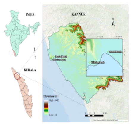
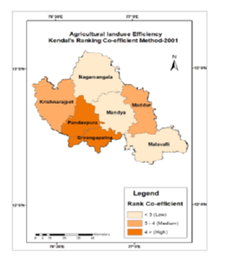
Land use is the actually made up any parcel of land, land use of any region is the result of the inhabitant’s impact on the land in the light of their preparation of landscape ecological factors in the region, developed through generation along with their capacity for absorption of technological skills. Land use is the surface utilization of all developed and vacant on a specific point, at a given time and space. The main objectives of this study are To study the spatial dynamics and land use of planning words in Mysore city. To study the spatial and temporal changes in the planning Mysore city. To access and analyze the impacts on spatial dynamics and land use changes within the study area. To propose planning strategies and suitable measures for planned growth of the study area. Mysore is located at 12◦18, N to 12◦30, N latitude and 77◦39, E t 76◦65, E longitude and has an average altitude of 770 meters. It is situated in southern region of state Karnataka, at the base of chamundi hill and spared across an area 128.42 sq.kms
Keywords: Land use, Planning, Spatial Dynamics.
Subscribe now for latest articles and news.