Geo-Eye
Department of Geography & GIS

Department of Geography & GIS

Geo-Eye
Year: 2018, Volume: 7, Issue: 2, Pages: 25-31
Original Article
B Pratheep Kumar1, T K Prasad2
1Asst. Prof. of Geography, Govt. Arts and Science College Kulathoor Neyyattinkara, Thiruvananthapuram
2Associate professor, Dept: of Geography Kannur University, Kerala
Received Date:10 September 2018, Accepted Date:16 November 2018
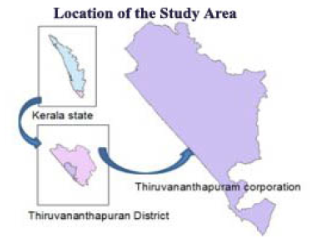
Apiculture now emerged as an important segment of agriculture in rural as well as urban areas. The prompt identification of beekeeping suitability areas is strategic for maximizing productivity. The Analytical Hierarchy Process is a tool to support decision-making in the identification of suitable sites with utmost potential for various agricultural practices. This study tested a GIS based AHP tool to assess urban beekeeping suitability zones in Thiruvananthapuram Corporation, Kerala state. Furthermore, the study utilized data, which were completely retrieved from various public sector repositories. The resulting map indicates, over 65% of the land area of the corporation have a high or very high potential of apiculture. The map can also be utilized by Government agencies to implement various promotional measures and also the beekeepers to identify suitable sites for apiary location and relocation for maximizing their profit. The study also created a model for utilization of public data domains for decision making, using GIS.
Keywords: Apiculture; multi-criteria decision analysis; GIS; AHP classification
© 2018 Kumar & Prasad. This is an open-access article distributed under the terms of the Creative Commons Attribution License, which permits unrestricted use, distribution, and reproduction in any medium, provided the original author and source are credited.
Published By Bangalore University, Bengaluru, Karnataka
Subscribe now for latest articles and news.