Geo-Eye
Department of Geography & GIS
Department of Geography & GIS
Geo-Eye
Year: 2023, Volume: 12, Issue: 1, Pages: 33-40
Original Article
T Ravikiran1,*, Ashok D Hanjagi2, P Surendra3
1 Department of Geography, Bangalore University, Jnanabharathi Campus, 560056, Bengaluru
2 Professor, Department of Geography, HOD, Bangalore University, Jnanabharathi Campus, 560056, Bengaluru
3 Assistant Professor, Department of Geography, Bangalore University, Jnanabharathi Campus, 560056, Bengaluru
*Corresponding author email: [email protected]
Received Date:09 February 2023, Accepted Date:17 April 2023
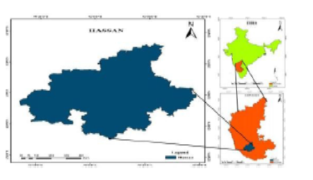
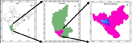
The present study is aiming to find the Hypsometric characterises of Kumaradhara river basin area, which is located in central western ghat region at an altitude of 1480 average MSL. Hypsometric concept which helps in understanding the condition of river over period of time that river has been gone through stage of different life cycles of erosional activities. Hypsometric Integral (HI) is other important factor which helps in identifying the state of river condition that is going through with calculational factor elevation and rate of erosion that occurred in river basin or region that river flows. The study area region is located at mid of Central western ghat region which falls under the category tropical evergreen forest region and semi evergreen region. Very rich in flora and fauna. Home for nearly 70 types endemic plants types which are very crucial in condition. Providing shelter for nearly 12000 types of species from unicellular bacteria to angiosperms, 4000 types of flowering plants, and hub of various international and national acts such as (ECZ) Ecological Sensitive Zone, Biodiversity Heritage zone, Western Ghat Ecological Expert panel (EGEEP) and Hotspot zone for many Endangered species. For the study ALOS PALSAR data of DEM (Digital Elevation Model) is main source which is having resolution of 12.5meter data, is very high-resolution data of free of cost and Terrain Error corrected data. Student version ArcGIS Software 10.8 is used for analysis work Bhukosh and Survey of India (SOI) Toposheet data are utilized in this research work. In terms of Methodology to carryout activity DEM is classified according to elevation Range difference and classified into groups and area basin is calculated and according to Strahler method streams order of six classified and later Hypsometric Integral (HI) is calculated and finally by using that Hypsometric curve is plotted on map along with this various theme based maps were generated like Geology, Lithology, Stram order and Hill shade and Relief maps of study area is generated and maps were used in analysis work. The result of Hypsometric integral analysis revels that the Kumaradhara river is in between of Monodoc to Equilibrium stage where it gives hint of river is stage of erosion, still there is lot of stable bases for river erosion activity and different course erosional activity is still allowed and process is in stage of continuation of river erosional activities.
Keywords
Hypsometric, River Equilibrium, Hypsometric Integral, HI analysis
© 2023 Ravikiran et al. This is an open-access article distributed under the terms of the Creative Commons Attribution License, which permits unrestricted use, distribution, and reproduction in any medium, provided the original author and source are credited.
Subscribe now for latest articles and news.