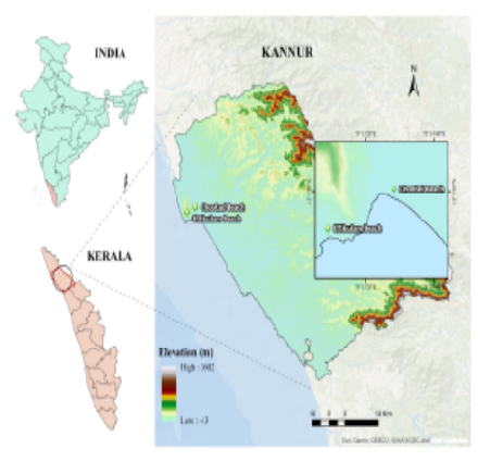
Geo-Eye

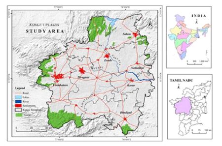
Department of Geography & GIS
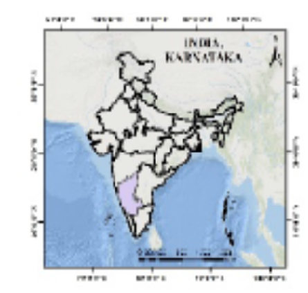
Article

Geo-Eye

Year: 2023, Volume: 12, Issue: 1, Pages: 1-11

Original Article

Geospatial Perspective for Innovative Planning and Management of Watershed

Received Date:08 February 2023, Accepted Date:18 May 2023

Abstract

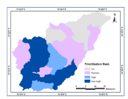
Innovative watershed management is intense to unravelling watershed related problems on a sustainable manner. Planning and managing developmental practices in the watershed on a sustainable basis usually integrate water or land and both in the present in such a way to attain its goal in the future also. The water-related problems in rain-fed agriculture are often related to high intensity and short duration rainfall, with large spatial and temporal variability, rather than to the low cumulative amount of rainfall. For the innovative planning and Management in the watershed, analysing land degradation through the prioritisation watersheds, assessing the surface runoff, evaluating the Spatio-temporal distribution of the hydrological constraints, groundwater potential zone delineations and the suitable sites for the Rainwater Harvesting (RWH) are considered by spatial multi-criteria evaluation from the several thematic layers that are determined from the remote sensing and GIS technologies. These innovative spatial technologies contribute to reducing vulnerability to climate change and help minimise or even reverse land degradation. The sustainable RWH will improve the surface and ground water level, this in turn improve the economy of the watershed.

Keywords: Geospatial, Innovations, Watershed, Rain­fed agriculture, Prioritisation, Groundwater

References

  1. Said A, Sehlke G, Stevens DK, Glover T, Sorensen D, Walker W, et al. Exploring an innovative watershed management approach: From feasibility to sustainability. Energy. 2006;31(13):2373–2386. Available from: https://doi.org/10.1016/j.energy.2006.02.002
  2. Chowdary VM, Ramakrishnan D, Srivastava YK, Chandran V, Jeyaram A. Integrated Water Resource Development Plan for Sustainable Management of Mayurakshi Watershed, India using Remote Sensing and GIS. Water Resources Management. 2009;23(8):1581–1602. Available from: https://doi.org/10.1007/s11269-008-9342-9
  3. Ibrahim-Bathis K, Ahmed SA. Geospatial technology for delineating groundwater potential zones in Doddahalla watershed of Chitradurga district, India. The Egyptian Journal of Remote Sensing and Space Science. 2016;19(2):223–234. Available from: https://doi.org/10.1016/j.ejrs.2016.06.002
  4. Biswas S, Sudharakar S, Desai VR. Prioritisation of subwatersheds based on morphometric analysis of drainage basin: a remote sensing and gis approach. Journal of lndian Society of Remote Sensing. 1999;27(2):155–166. Available from: https://doi.org/10.1007/BF02991569
  5. Ahmed SA, Chandrashekarappa KN, Raj SK, Nischitha V, Kavitha G. Evaluation of morphometric parameters derived from ASTER and SRTM DEM — A study on Bandihole sub-watershed basin in Karnataka. Journal of the Indian Society of Remote Sensing. 2010;38(2):227–238. Available from: https://doi.org/10.1007/s12524-010-0029-3
  6. Brouwer C, Prins K, Kay M, Heibloem M. Irrigation Water Management: Irrigation Methods (Training manual no 5). Rome, Italy. Food and Agriculture Organization. 1988.
  7. Omuto CT, Gumbe LO. Estimating water infiltration and retention characteristics using a computer program in R. Computers & Geosciences. 2009;35(3):579–585. Available from: https://doi.org/10.1016/j.cageo.2008.08.011
  8. Zhao L, Wang L, Liang X, Wang J, Wu F. Soil Surface Roughness Effects on Infiltration Process of a Cultivated Slopes on the Loess Plateau of China. Water Resources Management. 2013;27(14):4759–4771. Available from: https://doi.org/10.1007/s11269-013-0428-7
  9. Ma Y, Feng S, Su D, Gao G, Huo Z. Modeling water infiltration in a large layered soil column with a modified Green–Ampt model and HYDRUS-1D. Computers and Electronics in Agriculture. 2010;71(Supplement 1):S40–S47. Available from: https://doi.org/10.1016/j.compag.2009.07.006
  10. Machiwal D, Jha MK, Mal BC. Modelling Infiltration and quantifying Spatial Soil Variability in a Wasteland of Kharagpur, India. Biosystems Engineering. 2006;95(4):569–582. Available from: https://doi.org/10.1016/j.biosystemseng.2006.08.007
  11. Pedretti D, Fernàndez-Garcia D, Sanchez-Vila X, Barahona-Palomo M, Bolster D. Combining physical-based models and satellite images for the spatio-temporal assessment of soil infiltration capacity. Stochastic Environmental Research and Risk Assessment. 2011;25(8):1065–1075. Available from: https://doi.org/10.1007/s00477-011-0486-4
  12. Ismail M, Yacoub RK. Digital soil map using the capability of new technology in Sugar Beet area, Nubariya, Egypt. The Egyptian Journal of Remote Sensing and Space Science. 2012;15(2):113–124. Available from: https://doi.org/10.1016/j.ejrs.2012.08.001
  13. Manap MA, Nampak H, Pradhan B, Lee S, Sulaiman WNA, Ramli MF. Application of probabilistic-based frequency ratio model in groundwater potential mapping using remote sensing data and GIS. Arabian Journal of Geosciences. 2014;7(2):711–724. Available from: https://doi.org/10.1007/s12517-012-0795-z
  14. Konkul J, Rojborwornwittaya W, Chotpantarat S. Hydrogeologic characteristics and groundwater potentiality mapping using potential surface analysis in the Huay Sai area. Geosciences Journal. 2014;18(1):89–103. Available from: https://doi.org/10.1007/s12303-013-0047-6
  15. Sreedevi PD, Owais S, Khan HH, Ahmed S. Morphometric analysis of a watershed of South India using SRTM data and GIS. Journal of the Geological Society of India. 2009;73(4):543–552. Available from: https://doi.org/10.1007/s12594-009-0038-4
  16. Assatse WT, Nouck PN, Tabod CT, Akame JM, Biringanine GN. Hydrogeological activity of lineaments in Yaounde Cameroon region using remote sensing and GIS Techniques. The Egyptian Journal of Remote Sensing and Space Science. 2016;19(1):49–60. Available from: https://doi.org/10.1016/j.ejrs.2015.12.006
  17. Barron J, Rockström J, Gichuki F, Hatibu N. Dry spell analysis and maize yields for two semi-arid locations in east Africa. Agricultural and Forest Meteorology. 2003;117(1-2):23–37. Available from: https://doi.org/10.1016/S0168-1923(03)00037-6
  18. Ziadat F, Bruggeman A, Oweis T, Haddad N, Mazahreh S, Sartawi W, et al. A Participatory GIS Approach for Assessing Land Suitability for Rainwater Harvesting in an Arid Rangeland Environment. Arid Land Research and Management. 2012;26(4):297–311. Available from: https://doi.org/10.1080/15324982.2012.709214
  19. Glendenning CJ, Ogtrop FFV, Mishra AK, Vervoort RW. Balancing watershed and local scale impacts of rain water harvesting in India—A review. Agricultural Water Management. 2012;107:1–13. Available from: https://doi.org/10.1016/j.agwat.2012.01.011
  20. Sekar I, Randhir TO. Spatial assessment of conjunctive water harvesting potential in watershed systems. Journal of Hydrology. 2007;334(1-2):39–52. Available from: https://doi.org/10.1016/j.jhydrol.2006.09.024
  21. Ibrahim-Bathis K, Ahmed SA, Nischitha V, Mohammed-Aslam MA. Crop Water Requirements Analysis Using Geoinformatics Techniques in the Water-Scarce Semi-Arid Watershed. In: Pandey PC, Sharma LK., eds. Advances in Remote Sensing for Natural Resource Monitoring. (pp. 81-93) John Wiley; Sons, Ltd. 2021.

Copyright

© 2023 Ibrahim-Bathis et al. This is an open-access article distributed under the terms of the Creative Commons Attribution License, which permits unrestricted use, distribution, and reproduction in any medium, provided the original author and source are credited.

Published By Bangalore University, Bengaluru, Karnataka 

DON'T MISS OUT!

Subscribe now for latest articles and news.