Geo-Eye
Department of Geography & GIS

Department of Geography & GIS

Geo-Eye
Year: 2022, Volume: 11, Issue: 1, Pages: 22-25
Original Article
V Minutha1∗, P Jayashree2
1 Guest Faculty, Department of Studies in Geography, University of Mysore, Mysuru, 570006, Karnataka, India
2 Professor, Department of Studies in Geography, University of Mysore, Mysuru, 570006, Karnataka, India
*Corresponding author email: [email protected]
Received Date:02 March 2022, Accepted Date:12 May 2022
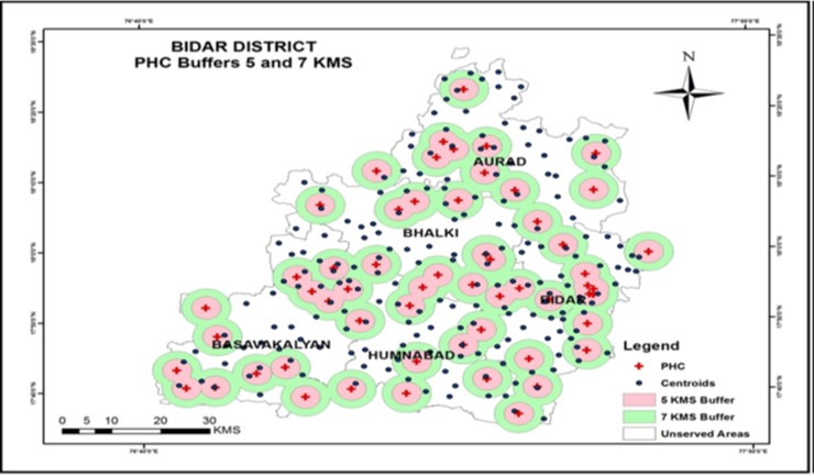
Human health plays an important role in the development of the region or the country. Health care system of any country or region has an important role to play for the sustainable health management. In this paper an attempt has been made to study the spatial distribution of public healthcare centers and their services in Bidar District. As a result, the present paper aimed to identity the served and unserved area by the health centers based on their functions. At present, totally there are 70 public health centers in the study area and each health centers has different types of structure and functions and served area of various sizes. So, there is a need to study the public health center, their function and served and unserved areas of each health centers to reduce the gaps and take into the consideration of unserved areas by proposing new healthcare centers in the study area. The Secondary data related to health care centres are collected from various offices like District Health Office and Taluk Health Office. The base map of study area has been geo-referenced and digitized using ARC GIS software. The Global positioning system (GPS) was adopted to take the coordinate of all the existing Public health centers in the study area. Data is analyzed through simple quantitative techniques like ratios, percentage and simple Euclidean buffers are mapped and analyzed to define the service area. The results show that the availability of healthcare centers are unequally distributed among the study area.
Keywords
Spatial, Health centers, Euclidean Buffer, GIS, GPS
© 2022 Minutha et al. This is an open-access article distributed under the terms of the Creative Commons Attribution License, which permits unrestricted use, distribution, and reproduction in any medium, provided the original author and source are credited.
Subscribe now for latest articles and news.