Geo-Eye
Department of Geography & GIS

Department of Geography & GIS

Geo-Eye
Year: 2020, Volume: 9, Issue: 1, Pages: 49-56
Original Article
Shahnin Irfan1*, Ashok D Hanjagi2
1Research Scholar, Department of Geography, Bangalore University, Bangalore 56
2Professor, Department of Geography, Bangalore University, Bangalore-56
*Corresponding Author
Email: [email protected]
Received Date:17 February 2020, Accepted Date:21 May 2020
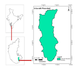
In the present study morphometric analysis of Arkavathi watershed is based on remote sensing and geographic information systems. The morphometric parameters are calculated with Carto sat DEM using Arc GIS 10.3 extension and Arc Hydrology tool in order to characterize it quantitatively. The current study involved determining the linear, aerial, and relief dimensions of the eight sub-watersheds for soil and water planning and management of the watershed. The watershed characterizes to have a dendritic pattern of drainage which has a medium stream frequency and moderate drainage density. Circularity ratio and form factor values indicate that sub watersheds are more or less elongated. The Length of the overland flow has a high value with gentle slopes and long flow paths. Understanding the procedures and methods of various morphometric factors can thus be used to prioritize watersheds for management, rainwater collection, and conservation planning.
Keywords: Morphometric Analysis; Carto SATDEM; Remote Sensing; GIS
© 2020 Irfan & Hanjagi. This is an open-access article distributed under the terms of the Creative Commons Attribution License, which permits unrestricted use, distribution, and reproduction in any medium, provided the original author and source are credited.
Published By Bangalore University, Bengaluru, Karnataka
Subscribe now for latest articles and news.