Geo-Eye
Department of Geography & GIS

Department of Geography & GIS

Geo-Eye
Year: 2018, Volume: 7, Issue: 1, Pages: 1-5
Original Article
H A Muniraja1, *
1 Research Scholar, Department of Geography, Bangalore University, Jnana Bharati Campus, Bangalore
Received Date:04 April 2018, Accepted Date:08 June 2018
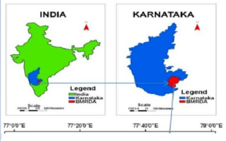
A lake is a terrain feature, a body of liquid on the surface of the world that is localized to the bottom of basin and moves slowly. It is a body of fresh or salt water of considerable size that is surrounded by land. The Bangalore Metropolitan Region lies towards the south-east in the south Indian state of Karnataka. The Bangalore Metropolitan Region situated between 12° 14’ 16’’ to 13° 30’ 26’’ north latitude & 77° 2’ 51’’ to 77° 57’ 45’’ east longitude. The total geographical area of Bangalore Metropolitan Region is 8005 sq Km. The main aim of the paper is to understand the situation and impact of vanished and encroached lakes. To reach set goals first literature collected from various works and to prepare maps for topography of Bangalore metropolitan region remote sensing data and GIS techniques are used. The results of environmental pollution of the lakes cause a serious chain of reaction in transfer, bio accumulation & deposition of pollutants in the system. For example aquatic plants play a key role in protecting water quality & providing habitat. In some cases the streams are cut off or blocked by constructions which often lead to urban floods during the heavy rains.
Keywords
Encroachment, lake, metropolitan region
© 2018 Muniraja. This is an open-access article distributed under the terms of the Creative Commons Attribution License, which permits unrestricted use, distribution, and reproduction in any medium, provided the original author and source are credited.
Published By Bangalore University, Bengaluru, Karnataka
Subscribe now for latest articles and news.